
Follow a Muhlenberg Township Street
A street-by-street search begins in the public Berks Property Records Search. Use the street number when it is known, add the street text, and then confirm that a result identifies the municipality as Muhlenberg Township. The result card supplies the UPI, the county parcel identifier, plus a site location, assessment-owner block, sale references, and a map link where available. Those are the anchors for a defensible address trail. A ZIP label or a display city alone is weaker because Reading and Temple postal labels cross municipal lines.
Work one parcel at a time. A street result can be broad, and the county does not present it as a casual whole-street household export. The useful sequence joins a current parcel to its deed reference, then lets historic sources add date-specific context. It also makes the limits visible early: an assessment owner is not automatically every person who occupies a location.
- Enter the address in Property Records Search and save the exact UPI, site location, municipality, and sales reference.
- Open the parcel map or GIS view, identify the relevant parcel outline, and record nearby UPIs only when another parcel must be checked.
- Use the sale date, instrument number, or deed book and page to locate the recorded title document.
- Read the deed’s grantor, grantee, legal description, and plan references before carrying the title trail backward.
- For a historical household question, pair a confirmed old address with a verified regional directory or census year rather than assuming continuous occupancy.
Muhlenberg Township Address Search Fields
The county form supports several ways to narrow a Muhlenberg Township street directory result. Address Number and Street are the main address fields. Direction and ZIP are optional refinements, while Parcel Number and Owner Name provide alternate routes when the full address is not known. Berks advises using a full or partial street name and, if a result is difficult to find, omitting street-type words such as road or avenue. The UPI accepts a partial value and is normally 14 to 17 characters long.
| Property-search field | How to use it | County format note |
|---|---|---|
| Parcel Number | Return directly to a known property card | UPI; partial input is accepted |
| Owner Name / Owner 2 | Test a recorded assessment-owner name | Last name first, no punctuation; percent wildcard permitted |
| Address Number | Focus a search on one house number | Text field, optional |
| Direction and Street | Find a road segment or a precise location | Direction menu plus full or partial street text |
| Zip Code | Narrow an address query | Use with street and municipality, not as a boundary claim |
The Berks Assessment Office maintains the ownership and assessment system behind the portal and offers a counter route when a current record needs clarification. CAMA extracts are countywide current files with their own license and use terms. They are not a substitute for reviewing a specific parcel card.
Berks Assessment’s public gateway is shown in the source below.
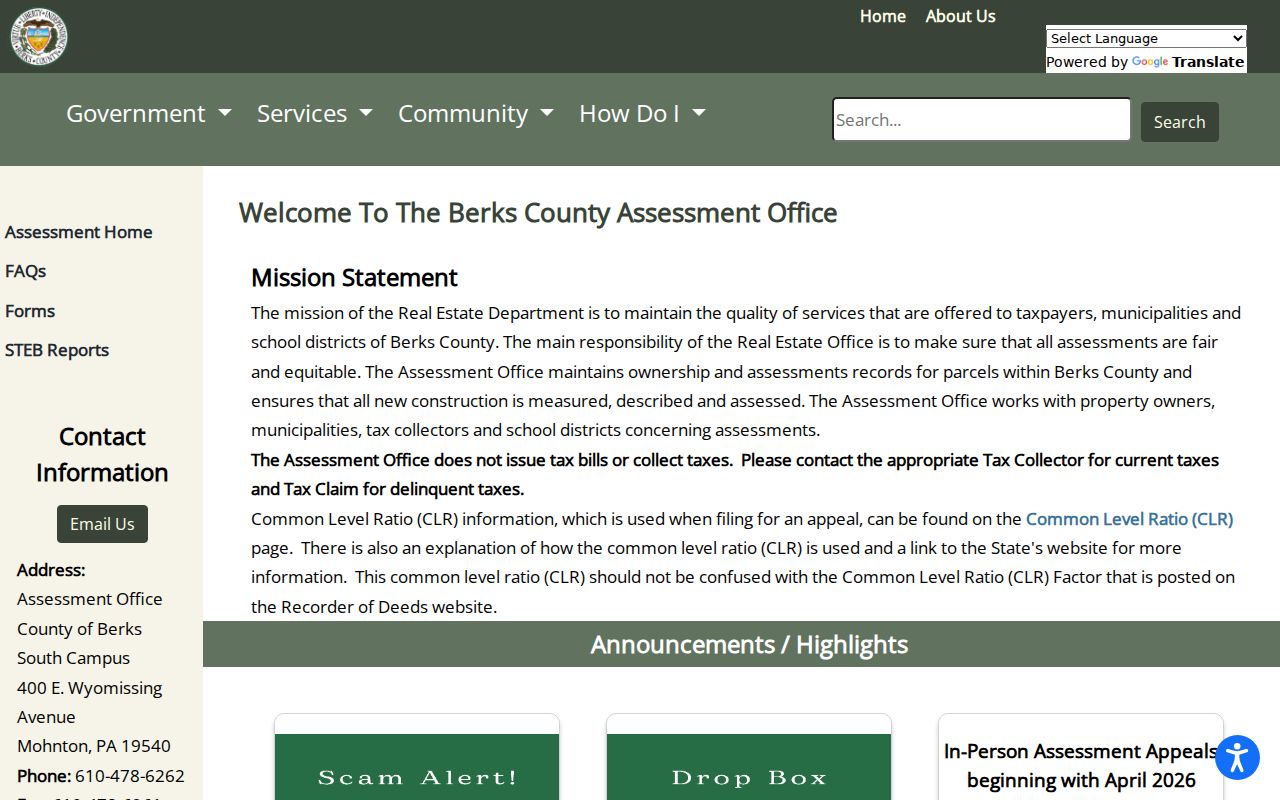
The assessment route is most useful at the start of a by-address search because it connects the modern street location to the UPI and sales information.
Muhlenberg Township Street UPI Tip
Use the municipality and UPI together before relying on a postal label. Official township facilities appear with both Reading 19605 and Temple 19560 mailing labels. Older material can also use Alsace, Laureldale, Hyde Park, Tuckerton, or Reading. Each may be useful as a search clue, but none settles present municipal jurisdiction. The Property Records Search municipality field and UPI give the stronger county link for a street directory search.
The Berks Mapping Office explains the map side of that connection. Its tax maps are a parcel-boundary inventory that helps map a PIN or UPI to a location. A legal description may use metes-and-bounds measurements or point back to an earlier deed or plan. That is why a parcel number often survives an address-label mismatch.
The Berks Mapping Office describes its parcel-map and legal-description resources here.
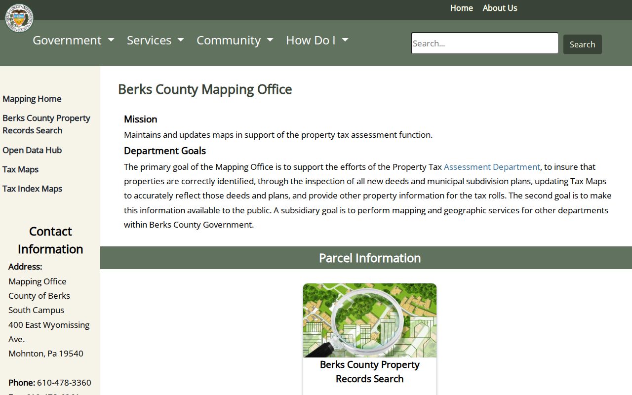
Keep the UPI in research notes alongside the municipality, because it is the bridge from a mapped parcel to the assessment card and recorded-document trail.
Muhlenberg Township Street Parcel Limits
A parcel card separates several fields that can look alike at first glance. Site Location is the property’s situs, meaning the physical real-estate location. Mailing Address is where assessment correspondence is sent. Owner 1 and Owner 2 identify the current assessment-owner fields. The displayed Resident/Non-Resident field must also be read as an assessment label, not expanded into a claim about a full household. A current card can show tax year, land and building values, land use, school district, sales data, deed references, permits, sketch, map, and exemption-related tabs when information is available.
- Parcel / UPI
- The county identifier that ties a particular assessment record to mapping and deed references.
- Situs address
- The physical location of the parcel, also called Site Location on the assessment card.
- Legal description
- The deed’s property description, often using measurements, lot references, or an earlier plan instead of a familiar street string.
- Criss-cross directory
- A historical address-to-name arrangement when a particular confirmed volume actually includes one.
A street directory should therefore describe an owner as the assessment owner and a correspondence address as mailing data. It should not claim a complete household, a utility account, a driver record, or the identity of anyone not listed by the actual custodian.
Map a Muhlenberg Township Street
GIS and tax maps are best used to understand parcel geography. Center a property, note its outline and UPI context, then return to the assessment portal for the card. Hardcopy tax maps do not carry static owner names because ownership changes too often. Berks reports 1,409 standard tax maps, and one property can require more than one sheet. Map acreage may differ from deed acreage, and a map is not a survey.
This separation matters on a long road or near a subdivision line. A visual parcel edge can suggest which record to inspect next, but a deed’s legal description and referenced plan resolve the title question. Do not treat adjacent outlines as evidence of a personal relationship.
Berks provides a public Property Map Search entry point for the mapping portion of an address search.
The map view supplies the parcel frame; the assessment record and deed supply the property facts that belong with it.
Muhlenberg Township Street Deed Trail
From the parcel card, copy the Sale Date, Sale Price, Validity Code, and the instrument number or deed book and page. Instrument numbers may appear after 2020, while earlier entries can be book and page. Search that reference in the Recorder’s system, then read the party roles and the legal description. A grantee is the party receiving an interest; a grantor is the party transferring one. Moving from the latest grantee to the prior grantor creates a title trail, but it does not alone identify everyone who lived at the address.
The Recorder reports computerized deed index and image coverage from the county’s 1752 founding. Original handwritten or typed books are retained for 1752 through 1953, microfilm covers 1953 through 2004, and later records are digitally retained with microfilm backup. Regular copies are listed at $0.50 per page, while the online cart adds order and certification charges where applicable. Check the live cart before ordering a copy.
The Recorder’s official search instructions explain the historic index routes.
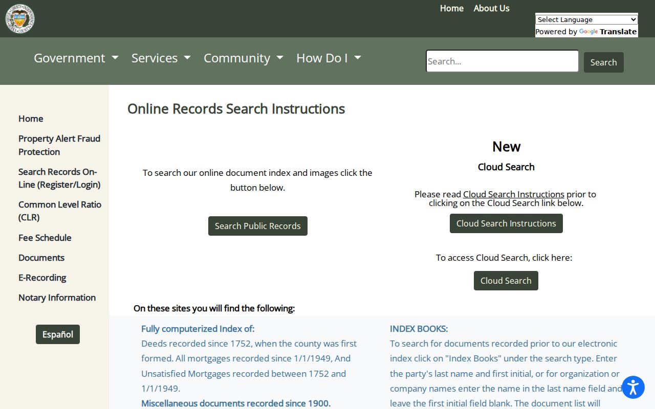
Those instructions are especially useful when a current street string does not appear in an earlier record and the legal description must carry the search.
The Recorder’s office page also explains copying, retention, and Property Alert.
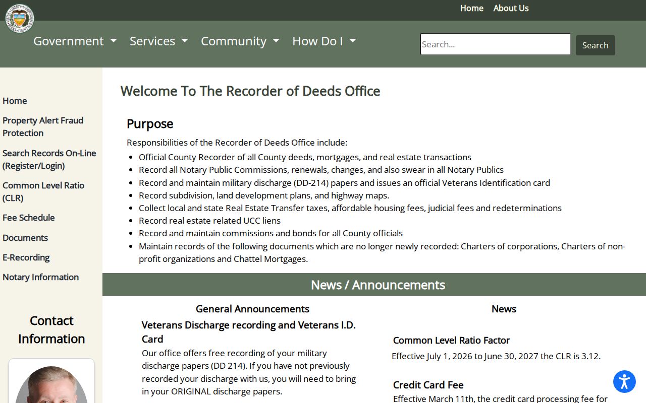
Property Alert can notify a current owner when a new recording matches a party name or a 14 to 17 digit parcel ID. It is an alert, not a title review or a finding that a document is valid.
Muhlenberg Township Street Index Quirk
Modern online searching is not the only Recorder route. For deeds and mortgages before 1926, Berks specifically recommends Index Books under General Criteria or search type. Enter the party’s last name and first initial, or place an organization name in the last-name field with the first-initial field blank. The books group names by similar sound, which helps when an older spelling changes between instruments.
Pre-1900 Miscellaneous Index Books are also the Recorder’s stated route for rights of way, easements, and related interests. Those records can explain why an older deed trail seems to break at a road, rail corridor, or plan reference. Copy the exact spelling, book reference, and property description before searching again. A single modern address query is not a complete title abstract.
Muhlenberg Township Street Transfer Files
Township property-transfer records can provide dated address context around a change in title. For a single-family property, the Township lists a $200 process made of a $75 occupancy permit and a $125 inspection. A seller, buyer, or representative may apply at the agreement of sale or at least 30 business days before settlement. The Code Enforcement Officer normally inspects within 15 business days after a complete application.
The inspection includes visible property numbering and code-related items such as smoke detectors, electrical service, GFCI protection, and sidewalk or curb maintenance. That makes a responsive existing file potential evidence of a transfer or inspection event. It is not a running roster of people at the location. No public completed-permit or code-case database was found in the research, so the proper fallback is a specific Township RTKL request or a call asking whether an address file exists.
The Township’s property-transfer procedure shows the official timing and fee details.
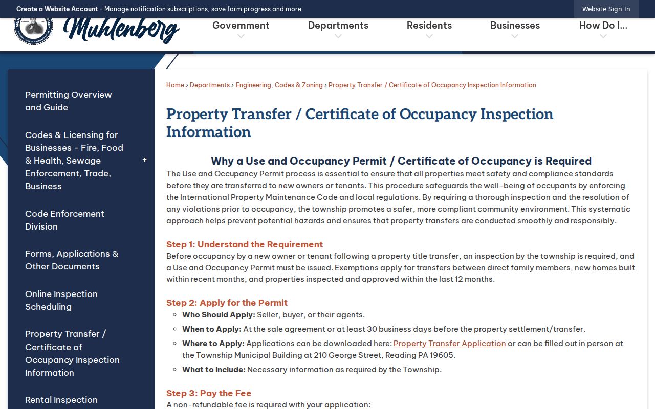
Use an address, UPI, date range, and requested record type when asking the Township for an existing file, and allow for lawful redaction or a no-record response.
Muhlenberg Township Street Lists
Pennsylvania’s Street List is a controlled election-record product, not an open browse tool. It can contain name, residence address, mailing address, party, and status. Berks Election Services receives the request through its public-information process. State law and the request affirmation limit the purpose and prohibit putting the supplied information on the internet. The personal voter-status service is for a person to check their own registration, not a general street directory.
The state lists a $20 county charge for electronic public-information products, including a Street List. A requestor must follow the cited rules in 25 Pa.C.S. §§ 1207(b), 1403(c), and 1404, along with the related regulations. Call Election Services before estimating a custom request because the Berks form does not publish every unit charge. Registration data remains an administrative record and does not prove current occupancy.
Note: Use a controlled Street List only through the custodian’s request process and never republish the supplied records.
Muhlenberg Township Address Records
Each address source has a narrow job. Combining them produces a stronger street directory result than asking one record to do everything. The county portal owns current assessment facts; mapping explains parcel layout; the Recorder preserves title and plan history. Township files may document a particular transfer or inspection. Older published directories require a confirmed volume and date before they can add a household lead.
| Address source | What it can establish | Access route |
|---|---|---|
| Assessment parcel card | UPI, situs, assessment owner, mailing field, sales and deed references | Public Property Records Search or Assessment counter |
| GIS and tax maps | Parcel boundaries, map context, and UPI linkage | GIS applications, tax maps, appointment or phone |
| Recorded deeds and plans | Parties, recording facts, legal description, and plan references | Cloud Search, Index Books, Recorder counter |
| Township transfer file | Possible transfer and inspection context for a responsive address record | Codes counter or targeted RTKL request |
| Historic directory | Time-stamped published address lead when a holding is confirmed | Library or archive collection |
The historical collections themselves belong to the Muhlenberg Township city directories trail. For street research, use them only after the parcel and deed work has supplied an era, a spelling, or a prior location to test.
Muhlenberg Township Street Place Labels
Historical labels can make one property appear to move when the boundary or postal description changed instead. Muhlenberg formed from western Alsace in 1851. Laureldale later incorporated from former township land in 1930. Township history also identifies communities including Temple, Tuckerton, Rosedale, Hyde Park, and Riverview. Match old directory, deed, census, or plan material to its period and parcel evidence rather than treating a Reading or Temple label as proof of a current municipality.
No authoritative source in the research identified a township-wide street renumbering or renaming project with a date. Do not invent one to reconcile a failed address search. Instead, compare the old wording with the legal description, lot or subdivision reference, municipality, and UPI. The Recorder’s plan records can be more useful than a street name when an address has changed.
Lawful Muhlenberg Township Street Use
A parcel card identifies a current assessment owner, not every person connected with a location. It cannot reliably reveal people who are not on title, protected Address Confidentiality Program participants, driver records, utility customers, or delivery accounts. Court references also do not prove that someone occupies a property. When an entry is wrong, ask the exact custodian about its correction or redaction process rather than trying to reconstruct private information from other sources.
Pennsylvania’s Address Confidentiality Program permits eligible participants to use a substitute address in several public systems. Its protection is a reason to stop, not an invitation to search around it. Public information is available for lawful personal research, family history, property questions, and civic understanding. Pennsylvania harassment and stalking laws, 18 Pa.C.S. §§ 2709 and 2709.1, apply when information is used to threaten, intimidate, surveil, or target a person.
Lawful use. Use Muhlenberg Township street records for legitimate personal research, and never use an address trail to stalk, harass, intimidate, or harm anyone.